Aerial Photography: 1950s - 1990s
Aerial photography has been of vital importance
in the development of a longer term view of the landcover and
population dynamics thoughout Nang Rong. Owing to its deeper
temporal depth than satellite imagery, which only began sensing the
landscape in the early 1970s, photography of Nang Rong has been
collected from aircraft mounted cameras for nearly 20 years prior the
first spaceborne Landsat sensor.
As the following series of photos shows, the changes
on the Nang Rong landscape from the mid-50s through the mid-90s was
dramatic. In the early and mid-50s, when Nang Rong was very much a
frontier, isolated from the major hubs of settlement, the human imprint
throughout the region was minor. Prior to the development of a
connected market economy, the only inhabitants in the region were
subsistence farmers, whose impact on the landscape was quite localized
and isolated. However, with the construction of roads and the
burgeoning market economy in Thailand, in-migration to the region
resulted in dramatic changes in land cover, especially in the broad
tracts of pristine forest in the southwest. Especially in Europe,
the demands for crops spurred the agricultural development in Nang
Rong. The 1970s were an exceedingly dynamic decade in Nang Rong,
with the majority of land conversion occuring in this 10 year
span. Again, examination of the series of photos below exemplifies
the utility of aerial photography in tracking and investigating the
marked changes in Nang Rong in the second half of the 20th
century. Below, the the left, is a zoomed in portion in the
southwest of the region. The broad expanses of forest that are
apparent in the 1950s and 60s are all but gone in the 1980s and 90s,
replaced by upland field crops and village settlement.
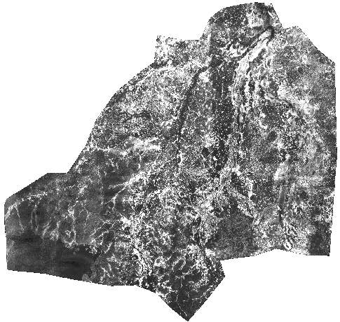
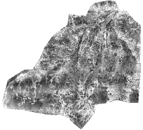
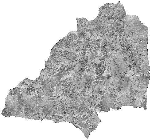
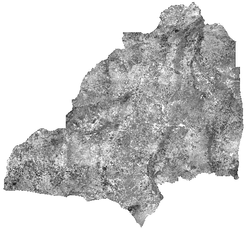
Below and to the right, the aerial photographs for each decade were mosaicked
together to provide seamless coverage of the entire district. The
digital aerial photograph mosaics are single channel, high spatial
resolution images that are easily combined with other digital data
contained in the GIS database and integrated as part of overlay
analyses and data visualizations. In addition to extending our
remote sensing time-series to deeper historical periods, the digital
mosaics, particularly those that correspond to field and/or social and
demographic surveys, are used to validate classifications of land
cover.
|
1954 Aerial Photo Subset
Date: 1954
Scale: 1:40,000
Click on the image for a larger view
|

1954 Aerial Photograph Mosaic
Click on the image for a larger view
|
|
1960s Aerial Photo Subset
Date: 1967-9
Scale: 1:50,000
Click on the image for a larger view |

1960s Aerial Photograph Mosaic
Click on the image for a larger view
|
|
1980s Aerial Photo Subset
Date: 1982-5
Scale: 1:15,000 & 1:40,000
Click on the image for a larger view |

1980s Aerial Photograph Mosaic
Click on the image for a larger view
|
|
1994 Aerial Photo Subset
Date: 1994
Scale: 1:50,000
Click on the image for a larger view |

1994 Aerial Photograph Mosaic
Click on the image for a larger view
|
