Remote
Sensing and the Nang Rong Projects
Remote sensing is an
invaluable resource in the spatial analyses for the Nang Rong Projects.
Spanning 1953 to 2003, the project utilizes a range of products,
ranging from aerial photography, to the next generation
satellite-based sensors, such as the Landsat Multispectral Scanner
(MSS), Thematic Mapper (TM), and Enhanced Thematic Mapper (ETM)
platforms. Taken together, these technologies allow for broad, regional views of
the entire district, facilitating in analyses of changing land use and
land cover, as well as in the tracking of development that has
accompanied the increasing population and commercialization of the
region.
Aerial Photography: 1950s-1990s
In the days before the advent of satellite based
sensing systems, remote sensing was done from cameras mounted on
airplanes. Aerial photography provided and still provides
relatively high resolution snapshots of Nang Rong at discrete points in
time. As opposed to Landsat imagery, the crisp nature of
the photos, ranging from 1:6000 to 1:50,000 in scale, allows for easy
manual interpretation and examination, as well as a more micro-scale
investigation of the landscape (below). Additionally, stereo
pairs of photos can be used to infer vegetation canopy and building
heights. However, as the generated
products are nothing more than black and white snapshots, the data
inherent in the photos is of limited utility owing to its lack of
multispectral information. As such, while features are clearly
recognizable and identifiable from air photos, underlying information
relating to vegetative health, subsurface material, moisture content, as
well as a host of others, cannot be readily gleaned.
Moreover, as with any remotely collected information, the products
invariably contain problems, such as camera anomalies, and, more
commonly, inconsistencies in the flight path of the plane (roll, pitch,
and yaw). Thus, data problems relating to distortion, contrast and
brightess, and flightline overlap are common. The Nang Rong
Project has air photos spanning nearly half a century: 1950s, 1960s, 1970s, 1980s ( 1:15,000 and 1:40,000), and
1990s.

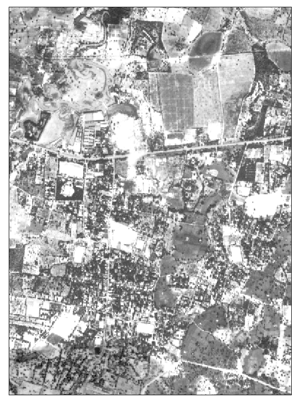
In this 1:50,000 aerial photograph from November 1994,
features on the ground are easily discernable. However,
without any spectral information, interpretation is visual
in nature, based on patterns, shades of gray, and
configuration.
|

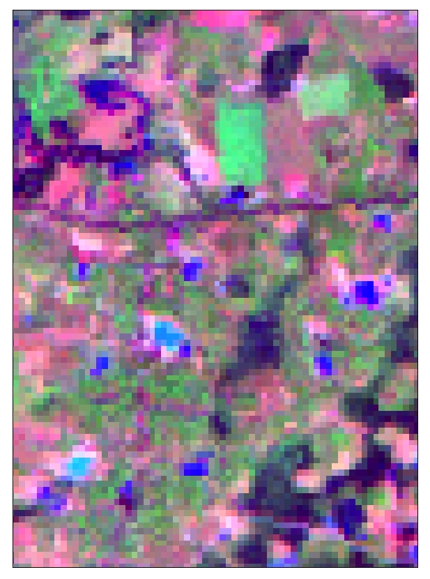
In this Landsat TM image from Novmeber 1994, features are
only vaguely recognizable owing to the relatively coarse
spatial resolution of 30 meters. Unlike the air photo to the
left, TM imagery contains spectral data, allowing for
additional information to be gleaned.
|
Satellite Imagery: 1970s-2000s
The primary sensor during the 1970s
and 1980s, Landsat MSS, with its 79 meter resolution and 4 band (3
visible, and 1 near infrared) spectral set, provides a broad view of
the major changes that began to occur throughout Nang Rong District in
the 1970s. Following MSS, Landsat TM, with an increased spatial
resolution of 30 meters and an increased spectral resolution of 6 bands
(3 visible, 1 near infrared, and 2 middle infrared), is the major
platform used by the Nang Rong Projects when examining and analyzing
the changes and developments in Nang Rong during the 1990s. Enhanced
Thematic Mapper, the latest Landsat sensor, began imaging the earth in
the late 1990s. ETM provides the same resolution as TM, but it adds a
15 meter panchromatic band. When used in tandem with or when used as a
supplement to the standard multispectral bands, the panchromatic band
facilitates a more detailed spatial view of the landscape through its
higher spatial resolution. Click here to jump to the image inventory of the Nang Rong Project.

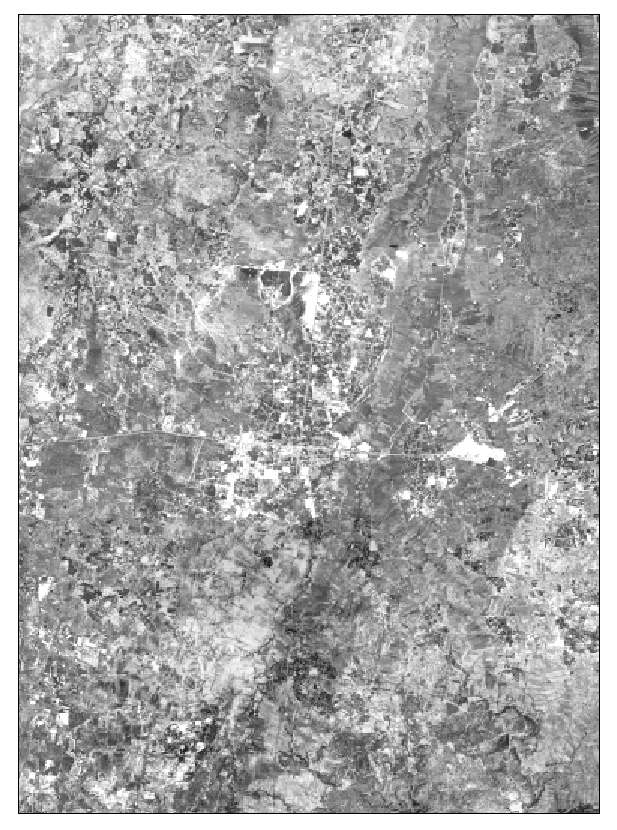
When the view is more regional in nature, the resolution
advantages of aerial photography are minimized. Still,
the above photo mosaic affords the viewer an excellent
medium scale overview of Nang Rong.
| 
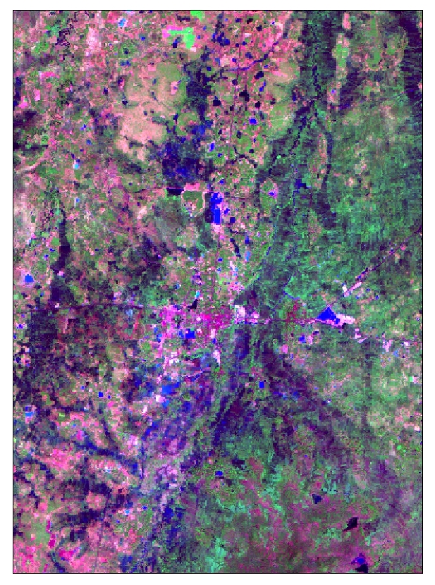
The advantages of satellite imagery are accentuated from a
regional perspective. Features that are not readily discernable
from the higher resolution aerial photos are more easily
recognizable owing to the spectral and spatial resolution of TM.
|
Aerial Photograph and Image Classification
Satellite
imagery, and to a lesser extent aerial photography, is used to track
and analyze the changing land use and land cover (LULC) in Nang Rong
through time. In order to create datasets that facilitate such
analyses, supervised and unsupervised classification methodologies and
techniques have been implemented. LULC classes that are both
prevalent and detectable from the images and photos are part of the
classification scheme. The Nang Rong Project utilizes both a land
use and a land cover methodology. Land use classification produces
broader, more general classes, while land cover breaks the land use
classes into more detailed classes. To view the land use
and land cover classes used in classifying the remotely sensed imagery,
click here. Click here to jump to the inventory of classified
images.
|
|
|
|
|
